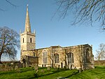
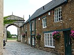
Grade I listed buildings in Rutland
Yi palo

Grade I ya-nima gari tusaa awɔi be England. Yaɣili ŋɔ nyɛla di bini pihita ayi ka din be Rutland.
Rutland
[mali niŋ | mali mi di yibu sheena n-niŋ]Notes
[mali niŋ | mali mi di yibu sheena n-niŋ]Kundivihira
[mali niŋ | mali mi di yibu sheena n-niŋ]External links
[mali niŋ | mali mi di yibu sheena n-niŋ]![]() Media related to Grade I listed buildings in Rutland at Wikimedia Commons
Media related to Grade I listed buildings in Rutland at Wikimedia Commons
- ↑ The date given is the date used by Historic England as significant for the initial building or that of an important part in the structure's description.A chirim ya:
&It;ref>tuma maa yi laɣingu din yuli nyɛ "note", ka lee bi saɣiritiri$It;references group ="note"/>tuka maa bon nya - ↑ Sometimes known as OSGB36, the grid reference is based on the British national grid reference system used by the Ordnance Survey.A chirim ya:
&It;ref>tuma maa yi laɣingu din yuli nyɛ "note", ka lee bi saɣiritiri$It;references group ="note"/>tuka maa bon nya - ↑ The "List Entry Number" is a unique number assigned to each listed building and scheduled monument by Historic England.A chirim ya:
&It;ref>tuma maa yi laɣingu din yuli nyɛ "note", ka lee bi saɣiritiri$It;references group ="note"/>tuka maa bon nya
Pubu pubu:
- Articles with short description
- Short description with empty Wikidata description
- Lists of coordinates
- Geographic coordinate lists
- Articles with Geo
- Articles with OS grid coordinates
- Commons category link is defined as the pagename
- Grade I listed buildings in Rutland
- Lists of Grade I listed buildings in England by county
- Lists of listed buildings in Rutland
- Peejinima din kundivira bi viɛla
- Pages with reference errors that trigger visual diffs


