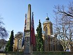
Grade I listed buildings in Northamptonshire
Yi palo
This article needs to be updated. (April 2023) |

Grade I ya-nima gari tusaa awɔi be England. Yaɣili ŋɔ kali la di din be Northamptonshire, ni di ni be distrikti shɛŋa. Distrikti shɛŋa din kana pɔi ni April 2021 be la (brackets) ni.
| Name | Location | Type | Completed [note 1] | Date designated | Grid ref.[note 2] Geo-coordinates |
Entry number [note 3] | Image |
|---|---|---|---|---|---|---|---|
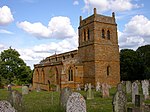
| Church of St Mary Magdalene | Cottingham, Corby | Parish Church | 12th century | 25 February 1957 | SP8461289944 52°30′03″N 0°45′18″W / 52.500844°N 0.75498°W |
1051745 |  |
| Church of St Peter | East Carlton, Corby | Parish Church | 1788 | 25 February 1957 | SP8313689329 52°29′44″N 0°46′37″W / 52.495543°N 0.776871°W |
1192313 |  |
| Church of St James the Great | Gretton, Corby | Parish Church | Early 12th century | 25 February 1957 | SP8985494417 52°32′25″N 0°40′36″W / 52.540207°N 0.676572°W |
1051731 |  |
| Kirby Hall (that part in Bulwick Civil Parish) | Deene, Gretton, Corby | Country House | 1570-1575 | 17 April 1972 | SP9258492694 52°31′27″N 0°38′13″W / 52.524266°N 0.636811°W |
1374889 |  |
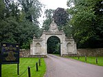
| Kirby Hall, attached walls and archways | Gretton, Corby | Country House | 1570-75 | 17 April 1972 | SP9258092698 52°31′27″N 0°38′13″W / 52.524302°N 0.636869°W |
1372559 |  |
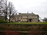
| Rockingham Castle | Rockingham, Corby | Castle | 13th century | 25 October 1951 | SP8670091375 52°30′48″N 0°43′26″W / 52.513378°N 0.723856°W |
1193409 |  |
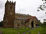
| Church of St Peter | Stanion, Corby | Parish Church | Mid 13th century | 25 February 1957 | SP9148086848 52°28′19″N 0°39′17″W / 52.471911°N 0.654683°W |
1193621 | 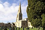 |
| Church of St Mary | Weldon, Corby | Parish Church | Early 13th century | 25 February 1957 | SP9278289336 52°29′39″N 0°38′05″W / 52.494052°N 0.634829°W |
1372577 | 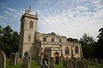 |
| Name | Location | Type | Completed [note 1] | Date designated | Grid ref.[note 2] Geo-coordinates |
Entry number [note 3] | Image |
|---|---|---|---|---|---|---|---|
| Church of All Saints | Aldwincle | Church | 13th century | 25 May 1967 | TL0112281522 52°25′20″N 0°30′52″W / 52.422348°N 0.514397°W |
1191528 |  |
| Church of St Peter | Aldwincle | Church | Late 12th century | 23 May 1967 | TL0061681862 52°25′32″N 0°31′18″W / 52.425497°N 0.521733°W |
1040308 |  |
| Lyveden New Bield | Aldwincle | Summerhouse | 1604-5 | 31 July 1987 | SP9840385309 52°27′25″N 0°33′12″W / 52.456878°N 0.553252°W |
1371907 |  |
| Lyveden Old Bield and attached Outbuildings | Aldwincle | House | Earlier | 23 May 1967 | SP9816885882 52°27′43″N 0°33′24″W / 52.462069°N 0.556541°W |
1040347 |  Upload Photo |
| Apethorpe Hall | Apethorpe Park, Apethorpe | Country house | 15th century | 23 May 1967 | TL0231895458 52°32′51″N 0°29′33″W / 52.547366°N 0.49254°W |
1040083 |  |
| Church of St Leonard | Apethorpe | Church | 14th century to 15th century | 23 May 1967 | TL0249695701 52°32′58″N 0°29′23″W / 52.549517°N 0.489841°W |
1371995 |  |
| Barnwell Castle | Barnwell St Andrew, Barnwell | Castle | About 1266 | 25 January 1988 | TL0491785203 52°27′17″N 0°27′27″W / 52.454714°N 0.457457°W |
1294426 |  |
| Church of St Andrew | Barnwell St Andrew, Barnwell | Church | Late 13th century | 23 May 1967 | TL0491884968 52°27′09″N 0°27′27″W / 52.452602°N 0.457516°W |
1040245 |  |
| Church of St Andrew | Brigstock | Church | Late 10th century | 23 May 1967 | SP9461385212 52°27′24″N 0°36′33″W / 52.456675°N 0.609038°W |
1371950 |  |
| Church of St Nicholas | Bulwick | Church | 13th century | 23 May 1967 | SP9628394252 52°32′15″N 0°34′55″W / 52.537627°N 0.581858°W |
1191576 |  |
| Church of St Andrew | Cotterstock | Church | Late 12th century | 23 May 1967 | TL0489890549 52°30′10″N 0°27′22″W / 52.502761°N 0.456055°W |
1040253 |  |
| Cotterstock Hall and attached Outbuildings | Cotterstock | Country House | 1658 | 1 July 1975 | TL0459290669 52°30′14″N 0°27′38″W / 52.503898°N 0.460524°W |
1293978 |  Upload Photo |
| Deene Hall | Deene Park, Deene | Country House | 16th century to 19th century | 23 May 1967 | SP9502392705 52°31′26″N 0°36′03″W / 52.523945°N 0.600871°W |
1040131 | 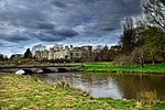 |
| Church of the Holy Trinity | Denford | Boiler House | 19th century | 23 May 1967 | SP9914676626 52°22′43″N 0°32′42″W / 52.378708°N 0.544892°W |
1040320 |  |
| Church of All Saints | Easton on the Hill | Church | 12th century | 23 May 1967 | TF0110904726 52°37′51″N 0°30′27″W / 52.630881°N 0.507536°W |
1266419 |  |
| Church of St Mary and All Saints | Fotheringhay | Church | 1434 | 23 May 1967 | TL0599593143 52°31′33″N 0°26′21″W / 52.52586°N 0.439075°W |
1371944 |  |
| Church of St John the Baptist | Harringworth | Church | Late 12th century | 23 May 1967 | SP9166097444 52°34′02″N 0°38′57″W / 52.567112°N 0.649116°W |
1040119 | 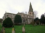 |
| Market Cross, approx. 10 Metres North West of Cross Farmhouse | Harringworth | Market Cross | 14th century | 23 May 1967 | SP9172697318 52°33′57″N 0°38′53″W / 52.565968°N 0.648178°W |
1192445 |  |
| Bede House | Higham Ferrers | Church Hall | 19th century | 23 September 1950 | SP9614068486 52°18′22″N 0°35′29″W / 52.306085°N 0.591365°W |
1191999 |  |
| Chantry Chapel of All Souls | Higham Ferrers | Chapel | Early 15th century | 23 September 1950 | SP9610368527 52°18′23″N 0°35′31″W / 52.30646°N 0.591896°W |
1040359 |  |
| Chichele College, North Range and attached Foundations | Higham Ferrers | Theological College | c. 1422 | 17 June 1987 | SP9599468665 52°18′28″N 0°35′36″W / 52.30772°N 0.593454°W |
1371908 |  |
| Chichele College, South and East Ranges and attached Foundations | Higham Ferrers | Gate | c. 1422 | 17 June 1987 | SP9602168645 52°18′27″N 0°35′35″W / 52.307535°N 0.593064°W |
1040390 |  |
| Church of St Mary | Higham Ferrers | Church | 13th century | 23 September 1950 | SP9614068527 52°18′23″N 0°35′29″W / 52.306454°N 0.591353°W |
1191957 |  |
| Churchyard Cross approx. 8 Metres West of Chantry Chapel of All Souls | Higham Ferrers | Cross | Early 14th century | 23 September 1950 | SP9608868519 52°18′23″N 0°35′32″W / 52.306391°N 0.592118°W |
1040360 |  |
| Market Cross 56 Metres North of Town Hall | Higham Ferrers | Market Cross | 14th century | 23 September 1950 | SP9604168497 52°18′22″N 0°35′34″W / 52.306202°N 0.592813°W |
1192024 | 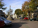 |
| Church of St Peter | Irthlingborough | Church | 1889-1893 | 8 May 1950 | SP9478770648 52°19′33″N 0°36′38″W / 52.325751°N 0.610594°W |
1040366 |  |
| Irthlingborough Old Bridge and attached Causeway (that Part in Irthlingborough Civil Parish) | Irthlingborough | Bridge | Mid 14th century | 8 May 1950 | SP9569370612 52°19′31″N 0°35′50″W / 52.325271°N 0.597315°W |
1040368 | 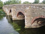 |
| Market Cross at Junction of Station and Finedon Roads | Irthlingborough | Market Cross | Mid 14th century | 8 May 1950 | SP9473170763 52°19′36″N 0°36′41″W / 52.326795°N 0.611383°W |
1192144 |  |
| Church of St Nicholas | Islip | Church | 14th century | 23 May 1967 | SP9867178911 52°23′58″N 0°33′04″W / 52.399329°N 0.551196°W |
1040326 |  |
| Church of All Saints | King's Cliffe | Church | Early 12th century | 23 May 1967 | TL0069497080 52°33′44″N 0°30′58″W / 52.562245°N 0.515989°W |
1225733 |  |
| Lilford Hall | Lilford Park, Lilford-cum-Wigsthorpe | Country House | 18th century | 23 May 1967 | TL0292884069 52°26′42″N 0°29′13″W / 52.444901°N 0.487065°W |
1189554 | 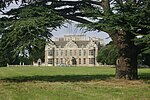 |
| Church of St Mary | Little Addington | Church | Late 13th century | 23 May 1967 | SP9589373563 52°21′06″N 0°35′37″W / 52.351758°N 0.59354°W |
1040336 |  |
| Church of St Peter | Lowick | Church | Early 14th century | 23 May 1967 | SP9776381006 52°25′06″N 0°33′50″W / 52.41832°N 0.563925°W |
1040265 |  |
| Drayton House | Drayton Park, Lowick | Country House | Late C13/Early 14th century | 23 May 1967 | SP9629980019 52°24′35″N 0°35′09″W / 52.409709°N 0.585728°W |
1040293 |  |
| Gates, Gatepiers and attached Screens approx. 600 Metres South East of South Front of Drayton House | Drayton Park, Lowick | Gate | Early 18th century | 23 May 1967 | SP9673379737 52°24′26″N 0°34′46″W / 52.407098°N 0.579432°W |
1040294 | 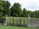 |
| Gates, Gatepiers and Screen approx. 70 Metres South East of South Front of Drayton House | Drayton Park, Lowick | Gate | 1701 | 23 May 1967 | SP9640379993 52°24′34″N 0°35′03″W / 52.409457°N 0.584207°W |
1371919 |  |
| Church of St Peter | Lutton | Church | Saxon | 23 May 1967 | TL1121087789 52°28′36″N 0°21′50″W / 52.476709°N 0.364027°W |
1040231 |  |
| Church of St Mary the Virgin and All Saints | Nassington | Cross | Saxon | 23 May 1967 | TL0632996174 52°33′11″N 0°25′59″W / 52.553033°N 0.433184°W |
1065930 |  |
| Prebendal Manor House | Nassington | Farmhouse | Until 1836 | 23 May 1967 | TL0629096126 52°33′09″N 0°26′02″W / 52.552609°N 0.433774°W |
1065975 |  |
| Church of St Peter | Newton Bromswold | Church | Mid 13th century to mid 14th century | 28 May 1954 | SP9981865858 52°16′55″N 0°32′18″W / 52.281811°N 0.538217°W |
1371900 |  |
| Berrystead | Oundle | House | c. 1700 | 18 June 1955 | TL0427888208 52°28′55″N 0°27′57″W / 52.481841°N 0.465918°W |
1190983 |  |
| Cobthorne | Oundle | House | 1700 | 18 June 1955 | TL0403088059 52°28′50″N 0°28′11″W / 52.48055°N 0.469615°W |
1372161 |  Upload Photo |
| Parish Church of St Peter | Oundle | Parish Church | Norman | 18 June 1955 | TL0419988196 52°28′54″N 0°28′02″W / 52.481749°N 0.467084°W |
1190787 |  |
| The Talbot Hotel, incl. Ranges of Stables and Barns at rear, Mounting Block near main Carriage Entrance | Oundle | Stables | 1552 | 18 June 1955 | TL0406688126 52°28′52″N 0°28′09″W / 52.481145°N 0.469064°W |
1372145 |  |
| Church of All Saints | Polebrook | Church | Late 12th century | 23 May 1967 | TL0684087060 52°28′16″N 0°25′43″W / 52.47103°N 0.428575°W |
1040232 |  |
| Church of St Peter | Raunds | Church | 12th century | 26 April 1950 | TL0004073087 52°20′48″N 0°31′58″W / 52.34674°N 0.532817°W |
1192206 |  |
| Church of the Nativity of the Blessed Virgin Mary | Ringstead | Church | 12th century | 23 May 1967 | SP9860875125 52°21′55″N 0°33′12″W / 52.365315°N 0.553234°W |
1286678 |  |
| Church of St Mary | Rushden | Church | Early 13th century | 9 December 1949 | SP9577266536 52°17′19″N 0°35′50″W / 52.288624°N 0.597314°W |
1266098 |  |
| Southwick Hall, attached Walls and Stable Block | Southwick | Hall | 16th century | 23 May 1967 | TL0213692177 52°31′04″N 0°29′46″W / 52.517915°N 0.496231°W |
1040240 |  |
| Church of St Laurence | Stanwick | Church | 13th century | 26 April 1950 | SP9801771457 52°19′57″N 0°33′47″W / 52.332455°N 0.56298°W |
1192232 |  |
| Castle Barn approx. 50 Metres North East of Thorpe Castle House | Thorpe Waterville, Thorpe Achurch | Barn | Early 14th century | 23 May 1967 | TL0225881433 52°25′17″N 0°29′52″W / 52.421337°N 0.497725°W |
1040149 |  Upload Photo |
| Church of St Mary the Virgin | Titchmarsh | Church | Mid 12th century | 23 May 1967 | TL0220579866 52°24′26″N 0°29′56″W / 52.407264°N 0.498982°W |
1265555 |  |
| Church of St John the Baptist | Wakerley | Church | 12th century | 23 May 1967 | SP9567299218 52°34′57″N 0°35′22″W / 52.582365°N 0.589432°W |
1234011 |  |
| Church of St Mary the Virgin | Warmington | Church | Late 12th century | 23 May 1967 | TL0773691010 52°30′23″N 0°24′51″W / 52.506351°N 0.414113°W |
1191333 |  |
| Church of St Mary | Woodford | Church | Mid 12th century | 23 May 1967 | SP9693876732 52°22′48″N 0°34′38″W / 52.380055°N 0.577288°W |
1225983 |  |
| Glebe Farmhouse | Woodford | Farmhouse | c1260-1320 | 23 May 1967 | SP9692876759 52°22′49″N 0°34′39″W / 52.3803°N 0.577427°W |
1225981 |  Upload Photo |
| Name | Location | Type | Completed [note 1] | Date designated | Grid ref.[note 2] Geo-coordinates |
Entry number [note 3] | Image |
|---|---|---|---|---|---|---|---|
| Church of St Mary | Ashley, Kettering | Church | Late 13th century | 25 February 1957 | SP7942291014 52°30′40″N 0°49′52″W / 52.51124°N 0.831162°W |
1052127 | 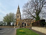 |
| Church of Saint Botolph | Barton Seagrave, Kettering | Church | Early 12th century | 27 February 1950 | SP8883677087 52°23′05″N 0°41′46″W / 52.384618°N 0.696187°W |
1051640 |  |
| Church of St Mary | Brampton Ash, Kettering | Church | 13th century | 25 February 1957 | SP7886687480 52°28′46″N 0°50′25″W / 52.479557°N 0.840189°W |
1052135 |  |
| Burton Latimer Hall and Wall attached to South | Burton Latimer, Kettering | Country House | Medieval | 18 January 1950 | SP8984875286 52°22′06″N 0°40′54″W / 52.368266°N 0.681804°W |
1372367 |  |
| Church of St Mary | Burton Latimer, Kettering | Parish Church | 12th century | 18 January 1950 | SP9031475017 52°21′57″N 0°40′30″W / 52.365772°N 0.675034°W |
1372364 |  |
| Church of St Andrew | Cransley, Kettering | Parish Church | Early 14th century | 25 February 1957 | SP8284576523 52°22′50″N 0°47′04″W / 52.380487°N 0.784328°W |
1213539 |  |
| Anglican and Methodist Church of St Giles | Desborough, Kettering | Cross | Anglo-Saxon | 24 January 1950 | SP8030683056 52°26′23″N 0°49′12″W / 52.439584°N 0.820054°W |
1213584 |  |
| Flats 1, 2, 3, Porch House, Bell Tower, Cloisters, South Wing, Pediment, Corner House and Tower House at Dingley Hall | Dingley, Kettering | Apartment | Late C20 | 25 October 1951 | SP7710387782 52°28′57″N 0°51′58″W / 52.482523°N 0.866073°W |
1294135 |  Upload Photo |
| Church of St Mary Magdalene | Geddington, Kettering | Parish Church | Anglo-Saxon | 25 February 1957 | SP8952483027 52°26′16″N 0°41′04″W / 52.437893°N 0.684494°W |
1052076 |  |
| Queen Eleanor's Cross | Geddington, Kettering | Statue | Shortly after 1290 | 25 February 1957 | SP8944683024 52°26′16″N 0°41′08″W / 52.437879°N 0.685642°W |
1286992 |  |
| Church of St James | Grafton Underwood, Kettering | Parish Church | Late C12/Early 13th century | 25 February 1957 | SP9219880226 52°24′44″N 0°38′45″W / 52.412275°N 0.645942°W |
1052049 |  |
| Dovecote, circa 160 Metres North East of Newton Field Centre | Newton and Little Oakley, Kettering | Dovecote | Late C16/Early 17th century | 25 February 1957 | SP8856083412 52°26′29″N 0°41′55″W / 52.44151°N 0.698569°W |
1192042 |  Upload Photo |
| Church of All Saints | Pytchley, Kettering | Church | 19th century | 25 February 1957 | SP8600374776 52°21′51″N 0°44′18″W / 52.364299°N 0.738392°W |
1288885 | 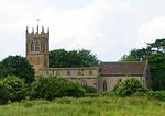 |
| Church of Holy Trinity | Rothwell, Kettering | Parish Church | 12th century | 12 June 1950 | SP8162081144 52°25′20″N 0°48′04″W / 52.422205°N 0.801195°W |
1288778 |  |
| Rothwell Market House | Rothwell, Kettering | Local Government Office | 1895 | 12 June 1950 | SP8166981209 52°25′22″N 0°48′02″W / 52.422781°N 0.800459°W |
1288812 |  |
| Rushton Hall School | Rushton, Kettering | Courtyard House | Early 16th century | 25 October 1951 | SP8364682758 52°26′11″N 0°46′16″W / 52.436405°N 0.771007°W |
1192160 |  |
| Rushton Triangular Lodge | Rushton, Kettering | Lodge | 1593-5 | 25 February 1957 | SP8304083072 52°26′22″N 0°46′47″W / 52.43932°N 0.779841°W |
1052038 |  |
| Church of St Edmund | Warkton, Kettering | Parish Church | 12th century | 25 February 1957 | SP8930779835 52°24′33″N 0°41′19″W / 52.40924°N 0.688537°W |
1192374 |  |
| Boughton House | Boughton Park, Weekley, Kettering | Great House | Early 16th century | 25 October 1951 | SP8997681532 52°25′28″N 0°40′42″W / 52.424383°N 0.678249°W |
1192643 | 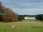 |
| Church of St Mary | Weekley, Kettering | Parish Church | c. 1100 | 25 February 1957 | SP8883580990 52°25′11″N 0°41′43″W / 52.419698°N 0.695167°W |
1192452 |  |
| Stable Block at Boughton House | Boughton Park, Weekley, Kettering | Stable | 1700-4 | 25 October 1951 | SP9007381577 52°25′29″N 0°40′37″W / 52.424771°N 0.676811°W |
1372406 |  Upload Photo |
| Church of St Peter and St Paul | Kettering | Church | c. 1300 | 27 February 1950 | SP8673978414 52°23′49″N 0°43′36″W / 52.396881°N 0.726646°W |
1051642 |  |
| Orangery at Barton Seagrave Hall | Barton Seagrave, Kettering | Orangery | Late 18th century | 27 February 1950 | SP8868077336 52°23′13″N 0°41′54″W / 52.386881°N 0.698413°W |
1051650 |  Upload Photo |
| Name | Location | Type | Completed [note 1] | Date designated | Grid ref.[note 2] Geo-coordinates |
Entry number [note 3] | Image |
|---|---|---|---|---|---|---|---|
| Church of St Leonard | Aston Le Walls, South Northamptonshire | Church | C12/C13 | 4 February 1969 | SP4955550808 52°09′12″N 1°16′38″W / 52.153337°N 1.277111°W |
1040412 |  |
| Aynhoe Park | Aynho, South Northamptonshire | Country house | Early 17th century | 11 September 1953 | SP5136633030 51°59′36″N 1°15′12″W / 51.993351°N 1.253314°W |
1040532 |  |
| Church of St Michael | Aynho, South Northamptonshire | Parish Church | 14th century | 4 February 1969 | SP5145133060 51°59′37″N 1°15′07″W / 51.993613°N 1.252071°W |
1371796 |  |
| Church of St John the Baptist | Upper Boddington, Boddington, South Northamptonshire | Church | 13th century | 4 February 1969 | SP4824453189 52°10′29″N 1°17′45″W / 52.174858°N 1.295934°W |
1041214 |  |
| Church of St Peter | Brackley, South Northamptonshire | Parish Church | Norman | 22 April 1950 | SP5917837303 52°01′52″N 1°08′20″W / 52.030988°N 1.138815°W |
1371808 | 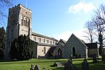 |
| Castle Ashby | Castle Ashby Park, Castle Ashby, South Northamptonshire | Country House | 1574-c1600 | 3 May 1968 | SP8626959249 52°13′29″N 0°44′18″W / 52.2247°N 0.738458°W |
1371298 | 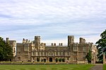 |
| Church of St Mary Magdalen | Castle Ashby Park, Castle Ashby, South Northamptonshire | Church | 14th century | 3 May 1968 | SP8636659137 52°13′25″N 0°44′13″W / 52.223678°N 0.737067°W |
1294095 | 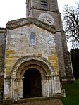 |
| Church of St Peter and St Paul | Chacombe, South Northamptonshire | Church | Early 14th century | 4 February 1969 | SP4907443947 52°05′30″N 1°17′06″W / 52.091701°N 1.285128°W |
1041190 |  |
| Church of St James | Chipping Warden and Edgcote, South Northamptonshire | Church | Early 13th century | 4 February 1969 | SP5050247906 52°07′38″N 1°15′49″W / 52.127163°N 1.263701°W |
1041169 |  |
| Church of St Peter and St Paul | Chipping Warden and Edgcote, South Northamptonshire | Church | Late 13th century | 4 February 1969 | SP4989248700 52°08′04″N 1°16′21″W / 52.134357°N 1.272495°W |
1041206 |  |
| Edgcote House | Chipping Warden and Edgcote, South Northamptonshire | Country House | 1748-54 | 11 September 1953 | SP5053147958 52°07′39″N 1°15′48″W / 52.127628°N 1.26327°W |
1041170 |  |
| Church of St Mary the Virgin | Whiston, Cogenhoe and Whiston, South Northamptonshire | Church | Early 16th century pre 1534 | 3 May 1968 | SP8519360520 52°14′11″N 0°45′14″W / 52.236291°N 0.753886°W |
1190018 |  |
| Church of St Peter and St Paul | Cosgrove, South Northamptonshire | Church | 13th century | 17 May 1960 | SP7909242457 52°04′29″N 0°50′51″W / 52.074838°N 0.847407°W |
1040847 | 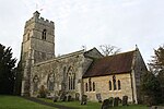 |
| Church of All Saints | Croughton, South Northamptonshire | Parish Church | 12th century | 4 February 1969 | SP5458333550 51°59′52″N 1°12′23″W / 51.99772°N 1.206383°W |
1192503 |  |
| Church of St Mary | Easton Neston Park, Easton Neston, South Northamptonshire | Church | 13th century | 17 May 1960 | SP7021449182 52°08′11″N 0°58′32″W / 52.136485°N 0.975535°W |
1189210 |  |
| Easton Neston House, and Attached Wing | Easton Neston Park, Easton Neston, South Northamptonshire | House | c1685-1695 | 1 December 1951 | SP7015749303 52°08′15″N 0°58′35″W / 52.13758°N 0.976343°W |
1189225 |  |
| Garden House at Easton Neston House | Easton Neston Park, Easton Neston, South Northamptonshire | Garden House | 1641 | 1 December 1951 | SP7031649449 52°08′20″N 0°58′26″W / 52.138872°N 0.97399°W |
1040989 |  Upload Photo |
| Left Gatepier of Original Entry to West of Easton Neston House | Easton Neston Park, Easton Neston, South Northamptonshire | Gate Pier | Mid 17th century | 1 December 1951 | SP6989749348 52°08′17″N 0°58′48″W / 52.138017°N 0.980132°W |
1040990 |  Upload Photo |
| Right Gatepier of Original Entry to West of Easton Neston House | Easton Neston Park, Easton Neston, South Northamptonshire | Gate Pier | Mid 17th century | 1 December 1951 | SP6990349304 52°08′15″N 0°58′48″W / 52.137621°N 0.980054°W |
1294338 |  Upload Photo |
| Eydon Hall | Eydon, South Northamptonshire | Country House | 1789-91 | 11 September 1953 | SP5397849791 52°08′38″N 1°12′45″W / 52.143781°N 1.212631°W |
1040463 |  |
| Chapel of St Peter | Steane, Farthinghoe, South Northamptonshire | Chapel | 13th century | 4 February 1969 | SP5545339020 52°02′49″N 1°11′34″W / 52.046808°N 1.192828°W |
1371825 |  Upload Photo |
| Church of St Michael | Farthinghoe, South Northamptonshire | Church | 1654 | 4 February 1969 | SP5361939791 52°03′14″N 1°13′10″W / 52.053919°N 1.219447°W |
1192622 | 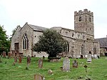 |
| Gayton Manor House | Gayton, South Northamptonshire | House | mid-late 16th century | 1 December 1951 | SP7056754833 52°11′14″N 0°58′09″W / 52.187237°N 0.969206°W |
1293835 |  |
| Church of St Bartholomew | Greens Norton, South Northamptonshire | Church | Mid 10th century to 11th century | 17 May 1960 | SP6690849902 52°08′36″N 1°01′25″W / 52.143367°N 1.023689°W |
1040874 |  |
| Church of Holy Trinity | Hinton-in-the-Hedges, South Northamptonshire | Church | 12th century | 4 February 1969 | SP5580636941 52°01′41″N 1°11′17″W / 52.028083°N 1.18802°W |
1040479 |  |
| Church of St Peter and St Paul | Kings Sutton, South Northamptonshire | Church | 12th century | 4 February 1969 | SP4974836114 52°01′16″N 1°16′35″W / 52.021223°N 1.276429°W |
1226135 |  |
| Church of St Luke | Kislingbury, South Northamptonshire | Parish Church | 14th century | 3 May 1968 | SP6972159655 52°13′50″N 0°58′50″W / 52.230689°N 0.980587°W |
1041048 |  |
| Church of St Lawrence | Marston St. Lawrence, South Northamptonshire | Parish Church | 13th century and 14th century | 4 February 1969 | SP5362242075 52°04′28″N 1°13′09″W / 52.074451°N 1.219045°W |
1371489 |  |
| Church of All Saints | Middleton Cheney, South Northamptonshire | Church | Early 14th century | 4 February 1969 | SP4985142032 52°04′28″N 1°16′27″W / 52.074416°N 1.274067°W |
1371514 |  |
| Church of St Guthlac | Passenham, Old Stratford, South Northamptonshire | Church | 13th century | 17 May 1960 | SP7803139438 52°02′52″N 0°51′49″W / 52.047851°N 0.863573°W |
1041642 |  |
| Two Barns at the Manor House | Passenham, Old Stratford, South Northamptonshire | Barn | Early 17th century | 1 December 1951 | SP7798539514 52°02′55″N 0°51′51″W / 52.048541°N 0.864227°W |
1293550 |  Upload Photo |
| The Chain Gate and Lodges and Attached Walls, Piers, Standards and Chains | Paulerspury, South Northamptonshire | Gate Lodge | 1822-3 | 1 December 1951 | SP7042947618 52°07′21″N 0°58′22″W / 52.122399°N 0.972718°W |
1041106 |  Upload Photo |
| Church of St Lawrence | Radstone, South Northamptonshire | Church | 12th century | 4 February 1969 | SP5879340523 52°03′36″N 1°08′38″W / 52.059976°N 1.143874°W |
1190302 | 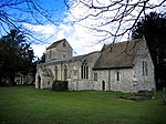 |
| The Monastery | Shutlanger, South Northamptonshire | Farmhouse | Early 14th century | 1 December 1951 | SP7311449973 52°08′36″N 0°55′59″W / 52.14322°N 0.933002°W |
1189534 |  Upload Photo |
| Church of St Botolph | Slapton, South Northamptonshire | Church | Early 13th century | 17 May 1960 | SP6401246885 52°07′00″N 1°04′00″W / 52.116589°N 1.066569°W |
1189807 |  |
| Sulgrave Manor House and attached Brewhouse | Sulgrave, South Northamptonshire | Farmhouse | Late 18th century | 4 February 1969 | SP5607945589 52°06′21″N 1°10′57″W / 52.105798°N 1.182624°W |
1371865 |  |
| Church of St Mary | Thenford, South Northamptonshire | Church | Late 12th century | 4 February 1969 | SP5189741533 52°04′11″N 1°14′39″W / 52.069743°N 1.244294°W |
1371503 |  |
| Thenford House | Thenford, South Northamptonshire | Country House | 1761-5 | 11 September 1953 | SP5218641797 52°04′20″N 1°14′24″W / 52.072089°N 1.240038°W |
1190951 |  |
| Church of St John the Baptist | Thorpe Mandeville, South Northamptonshire | Church | 14th century | 4 February 1969 | SP5322044954 52°06′01″N 1°13′28″W / 52.100371°N 1.224462°W |
1293503 |  |
| Church of St Lawrence | Towcester, South Northamptonshire | Church | 13th century | 17 May 1960 | SP6941048704 52°07′56″N 0°59′15″W / 52.13229°N 0.987378°W |
1371638 |  |
| The Court Parlour | Yardley Hastings, South Northamptonshire | Cross Passage House | Late 14th century | 3 May 1968 | SP8661457091 52°12′19″N 0°44′02″W / 52.205249°N 0.73396°W |
1190579 |  Upload Photo |
| Name | Location | Type | Completed [note 1] | Date designated | Grid ref.[note 2] Geo-coordinates |
Entry number [note 3] | Image |
|---|---|---|---|---|---|---|---|
| Church of St Mary | Bozeat, Wellingborough | Church | 12th century | 28 May 1954 | SP9061659204 52°13′25″N 0°40′29″W / 52.223598°N 0.674849°W |
1040795 |  |
| Church of All Saints | Earls Barton, Wellingborough | Church | Late 10th century | 28 May 1954 | SP8519063814 52°15′57″N 0°45′11″W / 52.265898°N 0.753101°W |
1294226 |  |
| Church of St Peter and St Paul | Easton Maudit, Wellingborough | Church | Late 13th century | 28 May 1954 | SP8886458819 52°13′14″N 0°42′02″W / 52.220423°N 0.700591°W |
1189610 |  |
| Church of St Mary Magdalene | Ecton, Wellingborough | Church | 13th century | 28 May 1954 | SP8286163547 52°15′50″N 0°47′14″W / 52.263854°N 0.787285°W |
1294128 |  |
| Church of St Mary the Virgin | Finedon, Wellingborough | Church | Mid 14th century | 23 September 1950 | SP9123971966 52°20′18″N 0°39′44″W / 52.338198°N 0.662282°W |
1371745 |  |
| The Old Vicarage | Great Doddington, Wellingborough | Manor House | 16th century | 28 May 1954 | SP8817164825 52°16′28″N 0°42′33″W / 52.274516°N 0.709167°W |
1371672 |  Upload Photo |
| Harrowden Hall (Wellingborough Golf Club) | The Slips, Great Harrowden, Wellingborough | Country House | 15th century | 28 May 1954 | SP8819470855 52°19′43″N 0°42′26″W / 52.32871°N 0.707253°W |
1040730 |  |
| Church of St Katherine | Irchester, Wellingborough | Church | Late 12th century | 28 May 1954 | SP9256466010 52°17′04″N 0°38′40″W / 52.284445°N 0.644476°W |
1040713 |  |
| Church of All Hallows | Wellingborough | Church | c. 1070 | 23 September 1950 | SP8918067960 52°18′09″N 0°41′37″W / 52.302531°N 0.693554°W |
1371761 |  |
| Church of St Mary the Virgin | Wellingborough | Village Hall | 1908 TO 1930 | 9 June 1970 | SP9013068043 52°18′11″N 0°40′47″W / 52.303122°N 0.679604°W |
1371787 |  |
| Tithe Barn | Wellingborough | Public Hall | C20 | 23 September 1950 | SP8912567744 52°18′02″N 0°41′40″W / 52.300598°N 0.694418°W |
1293485 |  |
Lihi pahi
[mali niŋ | mali mi di yibu sheena n-niŋ]Notes
[mali niŋ | mali mi di yibu sheena n-niŋ]Kundivihira
[mali niŋ | mali mi di yibu sheena n-niŋ]External links
[mali niŋ | mali mi di yibu sheena n-niŋ]![]() Media related to Grade I listed buildings in Northamptonshire at Wikimedia Commons
Media related to Grade I listed buildings in Northamptonshire at Wikimedia Commons
- 1 2 3 4 5 6 7 The date given is the date used by Historic England as significant for the initial building or that of an important part in the structure's description.A chirim ya:
&It;ref>tuma maa yi laɣingu din yuli nyɛ "note", ka lee bi saɣiritiri$It;references group ="note"/>tuka maa bon nya - 1 2 3 4 5 6 7 Sometimes known as OSGB36, the grid reference is based on the British national grid reference system used by the Ordnance Survey.A chirim ya:
&It;ref>tuma maa yi laɣingu din yuli nyɛ "note", ka lee bi saɣiritiri$It;references group ="note"/>tuka maa bon nya - 1 2 3 4 5 6 7 The "List Entry Number" is a unique number assigned to each listed building and scheduled monument by Historic England.A chirim ya:
&It;ref>tuma maa yi laɣingu din yuli nyɛ "note", ka lee bi saɣiritiri$It;references group ="note"/>tuka maa bon nya
Pubu pubu:
- Articles with short description
- Short description with empty Wikidata description
- Use dmy dates from April 2022
- Articles with invalid date parameter in template
- Wikipedia articles in need of updating from April 2023
- All Wikipedia articles in need of updating
- Lists of coordinates
- Geographic coordinate lists
- Articles with Geo
- Articles with OS grid coordinates
- Commons category link is defined as the pagename
- Grade I listed buildings in Northamptonshire
- Lists of Grade I listed buildings in England by county
- Lists of listed buildings in Northamptonshire
- Yaɣa din mali gadama ni lahabali konjɔɣu soya
- Peejinima din kundivira bi viɛla
- Pages with reference errors that trigger visual diffs


