
Lahabali kɔligu:Wothorpe Towers - geograph.org.uk - 1621167.jpg
Jɔhiyuli maa galisim:800 × 600 anfooni bihi bihi. Din pahi resolutions: 320 × 240 anfooni bihi bihi | 640 × 480 anfooni bihi bihi | 1,024 × 768 anfooni bihi bihi | 1,280 × 960 anfooni bihi bihi | 2,560 × 1,920 anfooni bihi bihi | 4,000 × 3,000 anfooni bihi bihi.
Faal maa maŋmaŋa (4,000 × 3,000 pixels, file size: 4.47 MB, MIME type: image/jpeg)
This is a photo of listed building number 1265972. |
Lahabali jia
| Buɣisibu |
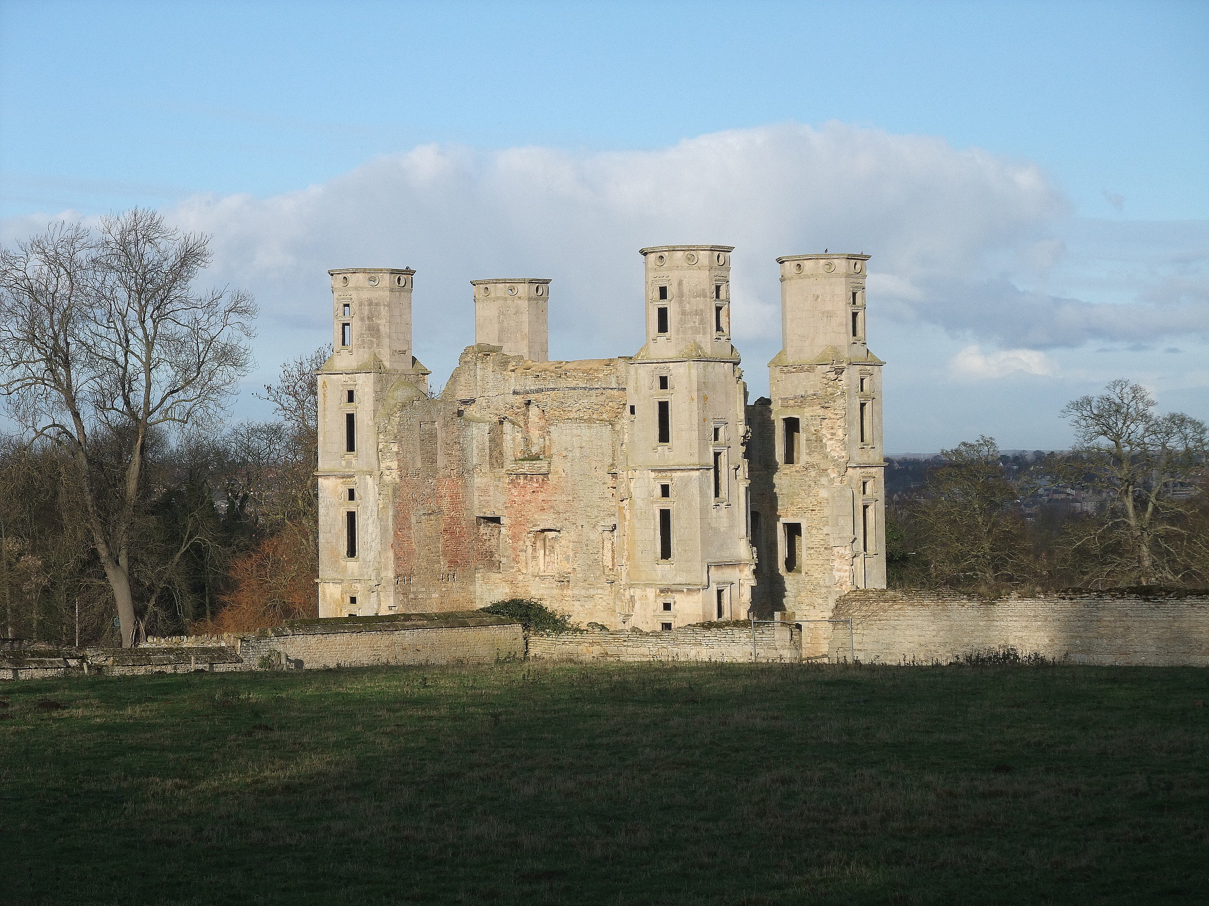
English: Wothorpe Towers, near to Easton on The Hill, Northamptonshire, Great Britain.
Grade I listed. Built by Thomas Cecil, eldest son of Lord Cecil of Burghley, in the early 17th century. Now undergoing extensive restoration <a title="http://www.wothorpe-towers.co.uk/" rel="nofollow" href="http://www.wothorpe-towers.co.uk/">Link</a><img style="padding-left:2px;" alt="External link" title="External link - shift click to open in new window" src="http://s0.geograph.org.uk/img/external.png" width="10" height="10"/> |
| Dabisili kalinli | |
| Nyabli | From geograph.org.uk; transferred by User:Skinsmoke using geograph_org2commons. |
| Sab'sabira | Tim Heaton |
| Soli tibu (Lahabali kɔligu ŋɔ labitum zaŋ tum tuma) |
Creative Commons Attribution Share-alike license 2.0 |
| ŋmahinli (required by the license) | Tim Heaton / Wothorpe Towers / |
| Camera location | | View this and other nearby images on: OpenStreetMap |
|---|
| Object location | | View this and other nearby images on: OpenStreetMap |
|---|
_region:GB-GBN_heading:0.00&language=dag)
Fukumisi shahira niŋbu

|
This image was taken from the Geograph project collection. See this photograph's page on the Geograph website for the photographer's contact details. The copyright on this image is owned by Tim Heaton and is licensed for reuse under the Creative Commons Attribution-ShareAlike 2.0 license.
|
This file is licensed under the Creative Commons Attribution-Share Alike 2.0 Generic license.
ŋmahinli: Tim Heaton
- A mali sɔli:
- N pirigi – Diyi lee ka a yan labi ŋma, n tari ka yan zaŋ tuma n talim
- Lab laɣim – n taɣi dee tuma maa
- N-yɛn zaŋ dɔli zalikpana ŋɔ sɔli:
- ŋmahindibu – Di tu ni a ti nin'tiɣili din tu, ka yooi sɔli din yihiri shiɛhira gbaŋ, ka lahi wuhi di yi niŋ ka taɣibu daa pun niŋ. A ni tooi niŋ lala ŋɔ n-doli hankali ni saɣi shɛm, amaa ka di pa sɔ'shɛli din mali biɛhiŋ zaŋ kpa ŋun tiri shiɛhira gbana ŋɔ polo nin'tiɣili ni nyini bee a zaŋ tum.
- Tarimi li din nyɛ shɛm – A yi mali labi sabi bee a taɣi li mi bee a miɛmi n-tam sabiri kurili maa zuɣu, di tu ni a tari a tɔhibu maa doli same or compatible license n-zali maŋ-maŋ maa.
Faal tarihi
Dihimi dabisili/saha n-nya kɔl' bihi kamani di ni di yina shɛm
| Zuŋɔ dabisili/Saha | Thumbnail | Di tarisi | ŋun su | tɔhibu | |
|---|---|---|---|---|---|
| din na chana | 02:42, 23 Silimin gɔli July 2021 | | 4,000 × 3,000 (4.47 MB) | Geograph Update Bot | Higher-resolution version from Geograph |
| 09:05, 30 Silimin gɔli September 2010 |  | 640 × 480 (62 KB) | File Upload Bot (Magnus Manske) | == {{int:filedesc}} == {{Information |Description={{en|1=Wothorpe Towers, near to Easton on The Hill, Northamptonshire, Great Britain. Grade I listed. Built by Thomas Cecil, eldest son of Lord Cecil of Burghley, in the early 17th century. Now undergoing e |
Lahibali kɔligu zaŋ tum tuma
Din doli ŋɔ na yaɣili tuma nima zaŋ ti lahabali kɔligu ŋɔ:
Duniya zaa lahabali kɔligu zaŋ tum tuma
Wikis shɛŋa ŋan dolina ŋɔ gba malila faal ŋɔ n kuri bukaata:
- Zaŋ tum tuma ceb.wikipedia.org zuɣuc
- Zaŋ tum tuma en.wikipedia.org zuɣuc
- Zaŋ tum tuma fr.wikipedia.org zuɣuc
- Zaŋ tum tuma sv.wikipedia.org zuɣuc
- Zaŋ tum tuma www.wikidata.org zuɣuc
- Zaŋ tum tuma zh-min-nan.wikipedia.org zuɣuc