
Lahabali kɔligu:The Church of St Thomas the Martyr, Upholland - geograph.org.uk - 2056849.jpg
Aayi di ku lahi tooi yaligi n-pahi.
The_Church_of_St_Thomas_the_Martyr,_Upholland_-_geograph.org.uk_-_2056849.jpg (640 × 480 pixels, file size: 118 KB, MIME type: image/jpeg)
This is a photo of listed building number 1201666. |
Lahabali jia
| Buɣisibu |
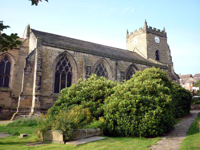
English: Nave and west tower of St Thomas the Martyr's parish church, Up Holland, Lancashire, England, seen from the northeast |
| Dabisili kalinli | |
| Nyabli | From geograph.org.uk; transferred by User:Belovedfreak using geograph_org2commons. |
| Sab'sabira | Karl and Ali |
| Soli tibu (Lahabali kɔligu ŋɔ labitum zaŋ tum tuma) |
Creative Commons Attribution Share-alike license 2.0 |
| ŋmahinli (required by the license) | Karl and Ali / The Church of St Thomas the Martyr, Upholland / |
| Camera location | | View this and other nearby images on: OpenStreetMap |
|---|
| Object location | | View this and other nearby images on: OpenStreetMap |
|---|
_region:GB-GBN_heading:225.00&language=dag)
Fukumisi shahira niŋbu

|
This image was taken from the Geograph project collection. See this photograph's page on the Geograph website for the photographer's contact details. The copyright on this image is owned by Karl and Ali and is licensed for reuse under the Creative Commons Attribution-ShareAlike 2.0 license.
|
This file is licensed under the Creative Commons Attribution-Share Alike 2.0 Generic license.
ŋmahinli: Karl and Ali
- A mali sɔli:
- N pirigi – Diyi lee ka a yan labi ŋma, n tari ka yan zaŋ tuma n talim
- Lab laɣim – n taɣi dee tuma maa
- N-yɛn zaŋ dɔli zalikpana ŋɔ sɔli:
- ŋmahindibu – Di tu ni a ti nin'tiɣili din tu, ka yooi sɔli din yihiri shiɛhira gbaŋ, ka lahi wuhi di yi niŋ ka taɣibu daa pun niŋ. A ni tooi niŋ lala ŋɔ n-doli hankali ni saɣi shɛm, amaa ka di pa sɔ'shɛli din mali biɛhiŋ zaŋ kpa ŋun tiri shiɛhira gbana ŋɔ polo nin'tiɣili ni nyini bee a zaŋ tum.
- Tarimi li din nyɛ shɛm – A yi mali labi sabi bee a taɣi li mi bee a miɛmi n-tam sabiri kurili maa zuɣu, di tu ni a tari a tɔhibu maa doli same or compatible license n-zali maŋ-maŋ maa.
Faal tarihi
Dihimi dabisili/saha n-nya kɔl' bihi kamani di ni di yina shɛm
| Zuŋɔ dabisili/Saha | Thumbnail | Di tarisi | ŋun su | tɔhibu | |
|---|---|---|---|---|---|
| din na chana | 19:57, 12 Silimin gɔli September 2010 | | 640 × 480 (118 KB) | File Upload Bot (Magnus Manske) | == {{int:filedesc}} == {{Information |Description={{en|1=The Church of St Thomas the Martyr, Upholland, near to Up Holland, Lancashire, Great Britain. Information here <span class="nowrap"><a title="http://www.stthomasthemartyr.org.uk/index.htm" rel="nofo |
Lahibali kɔligu zaŋ tum tuma
Din doli ŋɔ na yaɣili tuma nima zaŋ ti lahabali kɔligu ŋɔ:
Duniya zaa lahabali kɔligu zaŋ tum tuma
Wikis shɛŋa ŋan dolina ŋɔ gba malila faal ŋɔ n kuri bukaata:
- Zaŋ tum tuma arz.wikipedia.org zuɣuc
- Zaŋ tum tuma azb.wikipedia.org zuɣuc
- Zaŋ tum tuma de.wikipedia.org zuɣuc
- Zaŋ tum tuma en.wikipedia.org zuɣuc
- List of monastic houses in England
- Up Holland
- Civil parishes in Lancashire
- List of monastic houses in Lancashire
- Grade I listed buildings in Lancashire
- User:Skinsmoke/Sandbox/Civil parishes/Lancashire
- Up Holland Priory
- List of English abbeys, priories and friaries serving as parish churches
- Grade I listed churches in Lancashire
- Church of St Thomas the Martyr, Up Holland
- User:Nev1/Lancs Grade I
- Listed buildings in Up Holland
- Scheduled monuments in Lancashire
- Zaŋ tum tuma es.wikipedia.org zuɣuc
- Zaŋ tum tuma fa.wikipedia.org zuɣuc
- Zaŋ tum tuma nl.wikipedia.org zuɣuc
- Zaŋ tum tuma sco.wikipedia.org zuɣuc
- Zaŋ tum tuma www.wikidata.org zuɣuc