
Lahabali kɔligu:Site of St. Thomas a Becket's Church (Remains) - geograph.org.uk - 1500544.jpg
Aayi di ku lahi tooi yaligi n-pahi.
Site_of_St._Thomas_a_Becket's_Church_(Remains)_-_geograph.org.uk_-_1500544.jpg (640 × 480 pixels, file size: 69 KB, MIME type: image/jpeg)
_-_geograph.org.uk_-_1500544.jpg)
Lahabali jia
| Buɣisibu |
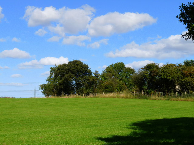
English: Site of St. Thomas a Becket's Church (Remains) The woodland marks the site of the remains of St. Thomas a Becket's Church. The Church was last used in 1849 and the intervening years have let the woodland take a firm hold of the site. The Church is still partial standing but only a few brief glimpses are afforded by the trees
This site: http://www.wynyardwoodlandpark.org.uk/GrindonChurch-ShortHistory.htm has an excellent history of the church. |
| Dabisili kalinli | |
| Nyabli | From geograph.org.uk |
| Sab'sabira | Graham Scarborough |
| ŋmahinli (required by the license) | Graham Scarborough / Site of St. Thomas a Becket's Church (Remains) / |
| Camera location | | View this and other nearby images on: OpenStreetMap |
|---|
_-_geograph.org.uk_-_1500544.jpg¶ms=054.621945_N_-001.387060_E_globe:Earth_type:camera_source:geograph-osgb36(NZ3967525372)_heading:45.00&language=dag)
| Object location | | View this and other nearby images on: OpenStreetMap |
|---|
_-_geograph.org.uk_-_1500544.jpg¶ms=054.622770_N_-001.385500_E_globe:Earth_class:object_type:object_source:geograph-osgb36(NZ39772546)_heading:45.00&language=dag)
Fukumisi shahira niŋbu

|
This image was taken from the Geograph project collection. See this photograph's page on the Geograph website for the photographer's contact details. The copyright on this image is owned by Graham Scarborough and is licensed for reuse under the Creative Commons Attribution-ShareAlike 2.0 license.
|
This file is licensed under the Creative Commons Attribution-Share Alike 2.0 Generic license.
ŋmahinli: Graham Scarborough
- A mali sɔli:
- N pirigi – Diyi lee ka a yan labi ŋma, n tari ka yan zaŋ tuma n talim
- Lab laɣim – n taɣi dee tuma maa
- N-yɛn zaŋ dɔli zalikpana ŋɔ sɔli:
- ŋmahindibu – Di tu ni a ti nin'tiɣili din tu, ka yooi sɔli din yihiri shiɛhira gbaŋ, ka lahi wuhi di yi niŋ ka taɣibu daa pun niŋ. A ni tooi niŋ lala ŋɔ n-doli hankali ni saɣi shɛm, amaa ka di pa sɔ'shɛli din mali biɛhiŋ zaŋ kpa ŋun tiri shiɛhira gbana ŋɔ polo nin'tiɣili ni nyini bee a zaŋ tum.
- Tarimi li din nyɛ shɛm – A yi mali labi sabi bee a taɣi li mi bee a miɛmi n-tam sabiri kurili maa zuɣu, di tu ni a tari a tɔhibu maa doli same or compatible license n-zali maŋ-maŋ maa.
Faal tarihi
Dihimi dabisili/saha n-nya kɔl' bihi kamani di ni di yina shɛm
| Zuŋɔ dabisili/Saha | Thumbnail | Di tarisi | ŋun su | tɔhibu | |
|---|---|---|---|---|---|
| din na chana | 21:39, 2 Silimin gɔli March 2011 | | 640 × 480 (69 KB) | GeographBot | == {{int:filedesc}} == {{Information |description={{en|1=Site of St. Thomas a Becket's Church (Remains) The woodland marks the site of the remains of St. Thomas a Becket's Church. The Church was last used in 1849 and the intervening years have let the woo |
Lahibali kɔligu zaŋ tum tuma
Din doli ŋɔ na yaɣili tuma nima zaŋ ti lahabali kɔligu ŋɔ:
Duniya zaa lahabali kɔligu zaŋ tum tuma
Wikis shɛŋa ŋan dolina ŋɔ gba malila faal ŋɔ n kuri bukaata:
- Zaŋ tum tuma ceb.wikipedia.org zuɣuc
- Zaŋ tum tuma en.wikipedia.org zuɣuc
- Zaŋ tum tuma sv.wikipedia.org zuɣuc
_-_geograph.org.uk_-_1500544.jpg)