
Lahabali kɔligu:Lesotho mountain village (5285775857).jpg

Jɔhiyuli maa galisim:800 × 600 anfooni bihi bihi. Din pahi resolutions: 320 × 240 anfooni bihi bihi | 640 × 480 anfooni bihi bihi | 1,024 × 768 anfooni bihi bihi | 1,280 × 960 anfooni bihi bihi | 2,560 × 1,920 anfooni bihi bihi | 3,264 × 2,448 anfooni bihi bihi.
Faal maa maŋmaŋa (3,264 × 2,448 pixels, file size: 2.45 MB, MIME type: image/jpeg)
.jpg)
Lahabali jia
| Buɣisibu |
Afrikaans: Die USAID-gesteunde Horse Riding for Health-program betrek plaaslike ponieruiters en motorfietsryers om bloedtoetse, medisyne en voorrade na Lesotho se afgeleë berggesondheidsklinieke te vervoer. Hul stelsel stel mense in staat om MIV-toetsresultate gouer te ontvang, toegang tot lewensreddende middels te kry en verseker 'n ononderbroke voorraad van medikasie. Met dank: Reverie Zurba/USAID.
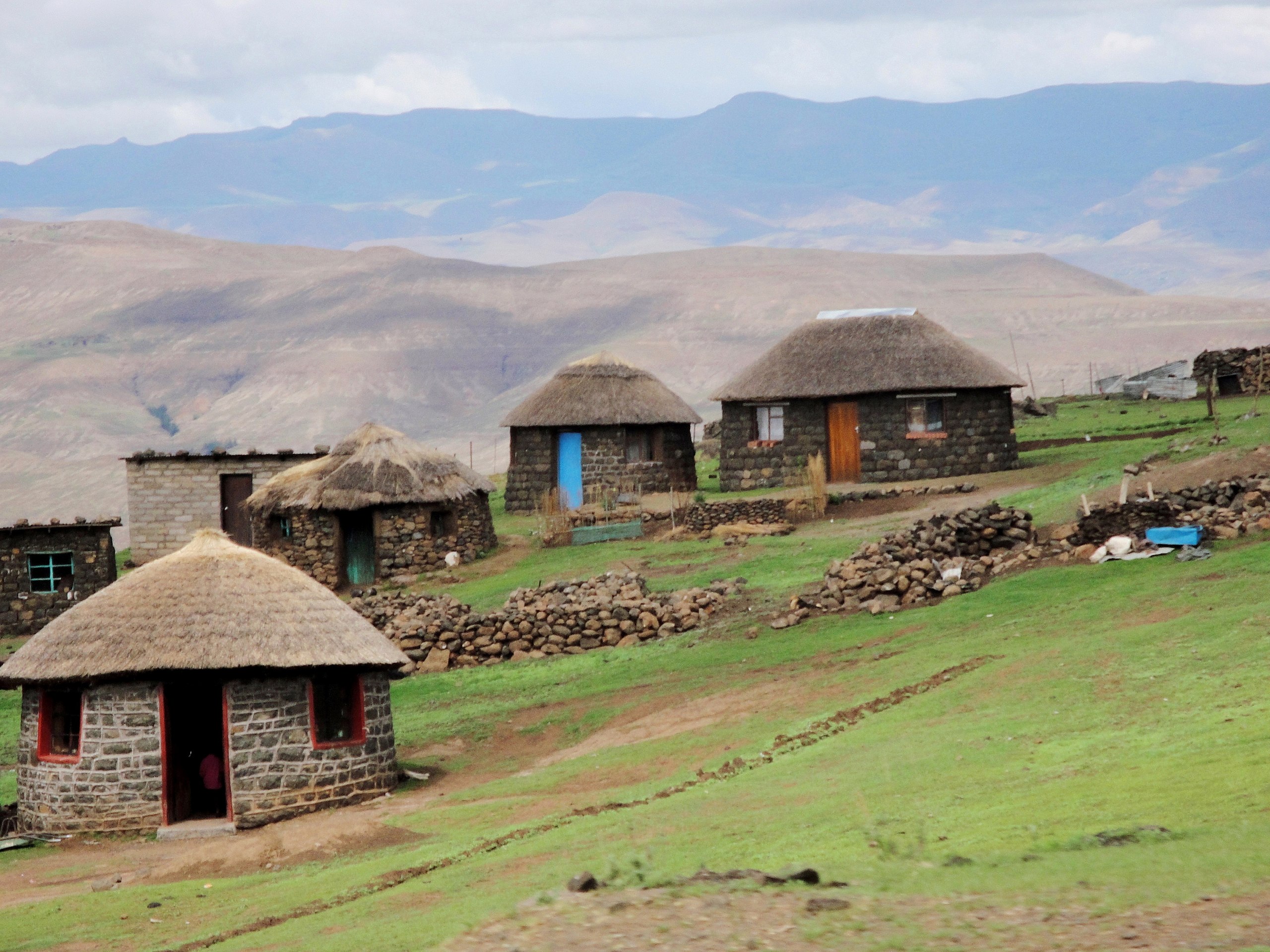
English: The USAID-supported Horse Riding for Health program engages local pony riders and motorcycle riders to transport blood tests, drugs, and supplies to Lesotho’s remote mountain health clinics. The system allows people to receive HIV test results sooner, access life-saving drugs, and ensure an uninterrupted supply of medication. Credit: Reverie Zurba/USAID. |
| Dabisili kalinli | |
| Nyabli |
|
| Sab'sabira | USAID Africa Bureau |
| Camera location | | View this and other nearby images on: OpenStreetMap |
|---|
.jpg¶ms=-29.219302_N_0029.003906_E_globe:Earth_type:camera_source:Flickr_&language=dag)
Fukumisi shahira niŋbu
This file is a work of an employee of the Executive Office of the President of the United States, taken or made as part of that person's official duties. As a work of the U.S. federal government, it is in the public domain.
|
 |
| This image, originally posted to Flickr, was reviewed on 19 September 2012 by the administrator or reviewer File Upload Bot (Magnus Manske), who confirmed that it was available on Flickr under the stated license on that date. |
Faal tarihi
Dihimi dabisili/saha n-nya kɔl' bihi kamani di ni di yina shɛm
| Zuŋɔ dabisili/Saha | Thumbnail | Di tarisi | ŋun su | tɔhibu | |
|---|---|---|---|---|---|
| din na chana | 07:30, 31 Silimin gɔli January 2022 | | 3,264 × 2,448 (2.45 MB) | JMK | adjust light and contrast, add some saturation |
| 15:18, 19 Silimin gɔli September 2012 |  | 3,264 × 2,448 (3.14 MB) | File Upload Bot (Magnus Manske) | Transferred from Flickr by User:Elitre |
Lahibali kɔligu zaŋ tum tuma
Din doli ŋɔ na yaɣili tuma nima zaŋ ti lahabali kɔligu ŋɔ:
Duniya zaa lahabali kɔligu zaŋ tum tuma
Wikis shɛŋa ŋan dolina ŋɔ gba malila faal ŋɔ n kuri bukaata:
- Zaŋ tum tuma arz.wikipedia.org zuɣuc
- Zaŋ tum tuma ast.wikipedia.org zuɣuc
- Zaŋ tum tuma bg.wikipedia.org zuɣuc
- Zaŋ tum tuma ca.wikipedia.org zuɣuc
- Zaŋ tum tuma ckb.wikipedia.org zuɣuc
- Zaŋ tum tuma cy.wikipedia.org zuɣuc
- Zaŋ tum tuma de.wikivoyage.org zuɣuc
- Zaŋ tum tuma diq.wikipedia.org zuɣuc
- Zaŋ tum tuma en.wikipedia.org zuɣuc
- Zaŋ tum tuma fr.wikivoyage.org zuɣuc
- Zaŋ tum tuma fy.wikipedia.org zuɣuc
- Zaŋ tum tuma ga.wikipedia.org zuɣuc
- Zaŋ tum tuma gd.wikipedia.org zuɣuc
- Zaŋ tum tuma gl.wikipedia.org zuɣuc
- Zaŋ tum tuma gpe.wikipedia.org zuɣuc
- Zaŋ tum tuma ha.wikipedia.org zuɣuc
- Zaŋ tum tuma hu.wikipedia.org zuɣuc
- Zaŋ tum tuma ia.wikipedia.org zuɣuc
- Zaŋ tum tuma ig.wikipedia.org zuɣuc
- Zaŋ tum tuma it.wikipedia.org zuɣuc
- Zaŋ tum tuma it.wikivoyage.org zuɣuc
- Zaŋ tum tuma ja.wikipedia.org zuɣuc
- Zaŋ tum tuma kab.wikipedia.org zuɣuc
- Zaŋ tum tuma ki.wikipedia.org zuɣuc
- Zaŋ tum tuma pap.wikipedia.org zuɣuc
- Zaŋ tum tuma ro.wikipedia.org zuɣuc
- Zaŋ tum tuma si.wikipedia.org zuɣuc
- Zaŋ tum tuma sr.wikipedia.org zuɣuc
- Zaŋ tum tuma st.wikipedia.org zuɣuc
- Zaŋ tum tuma te.wikipedia.org zuɣuc
- Zaŋ tum tuma tl.wikipedia.org zuɣuc
- Zaŋ tum tuma tum.wikipedia.org zuɣuc
- Zaŋ tum tuma vec.wikipedia.org zuɣuc
- Zaŋ tum tuma www.wikidata.org zuɣuc
- Zaŋ tum tuma zh.wikipedia.org zuɣuc
.jpg)