
Lahabali kɔligu:Baton Rouge Louisiana waterfront aerial view.jpg
Jɔhiyuli maa galisim:750 × 600 anfooni bihi bihi. Din pahi resolutions: 300 × 240 anfooni bihi bihi | 600 × 480 anfooni bihi bihi | 960 × 768 anfooni bihi bihi | 1,280 × 1,024 anfooni bihi bihi | 1,500 × 1,200 anfooni bihi bihi.
Faal maa maŋmaŋa (1,500 × 1,200 pixels, file size: 1.04 MB, MIME type: image/jpeg)
| Buɣisibu |
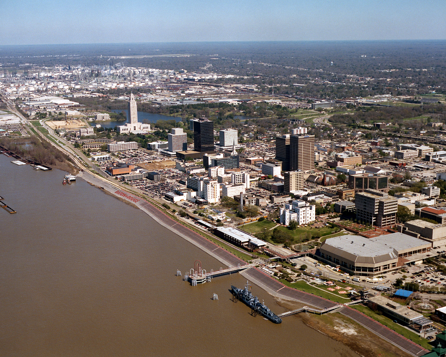
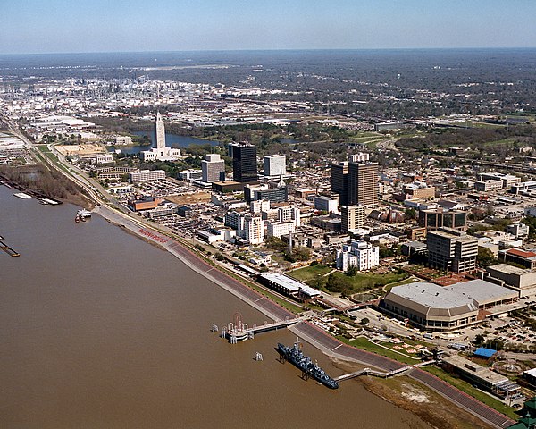
English: Aerial view of the riverfront area of Baton Rouge, Louisiana, USA. The city fronts on the Mississippi River in the center of Louisiana. The tall state capitol tower can be seen at center left. The historic destroyer USS Kidd is moored in the river at the bottom of the picture. View is to the north-northeast. |
|||
| Dabisili kalinli | ||||
| Nyabli |
U.S. Army Corps of Engineers Digital Visual Library Image page Image description page Digital Visual Library home page |
|||
| Sab'sabira | Michael Maples, U.S. Army Corps of Engineers | |||
| Soli tibu (Lahabali kɔligu ŋɔ labitum zaŋ tum tuma) |
|
|||
| Location | Baton Rouge, Louisiana, USA |
| Camera location | | View this and other nearby images on: OpenStreetMap |
|---|
Faal tarihi
Dihimi dabisili/saha n-nya kɔl' bihi kamani di ni di yina shɛm
| Zuŋɔ dabisili/Saha | Thumbnail | Di tarisi | ŋun su | tɔhibu | |
|---|---|---|---|---|---|
| din na chana | 03:05, 6 Silimin gɔli April 2007 | | 1,500 × 1,200 (1.04 MB) | DanMS | {{Information | Description = {{en|Aerial view of the riverfront area of Baton Rouge, Louisiana, USA. The ctiy fronts on the Mississippi River in the center of Louisiana. The tall state capital tower can be seen at center left. The historic destroyer U |
Lahibali kɔligu zaŋ tum tuma
Din doli ŋɔ na yaɣili tuma nima zaŋ ti lahabali kɔligu ŋɔ:
Duniya zaa lahabali kɔligu zaŋ tum tuma
Wikis shɛŋa ŋan dolina ŋɔ gba malila faal ŋɔ n kuri bukaata:
- Zaŋ tum tuma af.wikipedia.org zuɣuc
- Zaŋ tum tuma an.wikipedia.org zuɣuc
- Zaŋ tum tuma ar.wikipedia.org zuɣuc
- Zaŋ tum tuma arz.wikipedia.org zuɣuc
- Zaŋ tum tuma ast.wikipedia.org zuɣuc
- Zaŋ tum tuma az.wikipedia.org zuɣuc
- Zaŋ tum tuma bat-smg.wikipedia.org zuɣuc
- Zaŋ tum tuma be-tarask.wikipedia.org zuɣuc
- Zaŋ tum tuma be.wikipedia.org zuɣuc
- Zaŋ tum tuma bg.wikipedia.org zuɣuc
- Zaŋ tum tuma br.wikipedia.org zuɣuc
- Zaŋ tum tuma ca.wikipedia.org zuɣuc
- Zaŋ tum tuma ceb.wikipedia.org zuɣuc
- Zaŋ tum tuma ce.wikipedia.org zuɣuc
- Zaŋ tum tuma cy.wikipedia.org zuɣuc
- Zaŋ tum tuma da.wikipedia.org zuɣuc
- Zaŋ tum tuma de.wikipedia.org zuɣuc
- Zaŋ tum tuma de.wikivoyage.org zuɣuc
- Zaŋ tum tuma diq.wikipedia.org zuɣuc
- Zaŋ tum tuma el.wikipedia.org zuɣuc
- Zaŋ tum tuma en.wikipedia.org zuɣuc
- Zaŋ tum tuma en.wikinews.org zuɣuc
- Zaŋ tum tuma en.wikivoyage.org zuɣuc
- Zaŋ tum tuma en.wiktionary.org zuɣuc
- Zaŋ tum tuma es.wikipedia.org zuɣuc
- Zaŋ tum tuma et.wikipedia.org zuɣuc
- Zaŋ tum tuma eu.wikipedia.org zuɣuc
- Zaŋ tum tuma fi.wikipedia.org zuɣuc
- Zaŋ tum tuma fr.wikipedia.org zuɣuc
- Zaŋ tum tuma fr.wikivoyage.org zuɣuc
- Zaŋ tum tuma fy.wikipedia.org zuɣuc
- Zaŋ tum tuma ga.wikipedia.org zuɣuc
- Zaŋ tum tuma gl.wikipedia.org zuɣuc
- Zaŋ tum tuma he.wikipedia.org zuɣuc
- Zaŋ tum tuma he.wikivoyage.org zuɣuc
- Zaŋ tum tuma hsb.wikipedia.org zuɣuc
- Zaŋ tum tuma ht.wikipedia.org zuɣuc
- Zaŋ tum tuma hu.wikipedia.org zuɣuc
Yulima more global usage zaŋ chaŋ lahabali kɔligu ŋɔ.